
Global cartographic standards represent more than just geography; they act as a baseline for regional stability and diplomatic precision. Recently, the Nepal Airlines Kashmir map triggered significant digital friction after the national carrier’s international route network appeared to show the disputed Kashmir region as part of Pakistan. This structural oversight immediately encountered resistance from Indian digital users, forcing a rapid recalibration of the airline’s public messaging.
Analyzing the Nepal Airlines Kashmir Map Friction
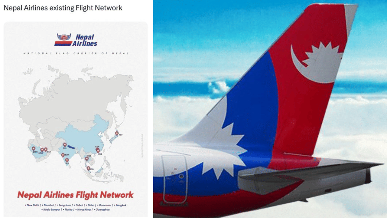
The controversy erupted following a social media update that showcased the airline’s global reach. In the map, the cartographic alignment placed Kashmir within Pakistan’s borders. Consequently, the image catalyzed a surge of online outrage among Indian observers. Indian users demanded immediate government intervention, viewing the representation as a politically sensitive error rather than a technical glitch.

Strategic communication experts note that such inaccuracies often lead to calls for bans and diplomatic boycotts. In this case, the Nepal Airlines Kashmir map acted as a catalyst for escalating demands to restrict the carrier’s operations within Indian territory. As the situation reached a baseline of high volatility, the airline removed the post to mitigate further reputational damage.
The Translation: Clear Context
In the realm of international relations, maps are not just navigation tools; they are calibrated political statements. The “technical error” mentioned by the airline refers to a failure in cartographic accuracy where the source data did not align with the host nation’s official stance. This incident illustrates how a lack of precision in digital assets can inadvertently signal a momentum shift in foreign policy, even if the intent was purely operational.
The Socio-Economic Impact
How does this development affect the daily life of a Pakistani citizen? Specifically, it highlights the following structural realities:
- Digital Diplomacy Awareness: Citizens are increasingly aware that digital representation is a new frontier for national identity.
- Travel Connectivity: Diplomatic friction caused by such incidents can lead to flight restrictions, affecting students and professionals who rely on regional carriers for cost-effective transit.
- Regional Sentiment: Such developments often reinforce the perceived global shift in how international entities view regional boundaries, impacting national morale.
The Forward Path: Expert Opinion
This event represents a Stabilization Move. While the initial post caused a ripple of progress in Pakistan’s digital narrative, the immediate apology and internal review by Nepal Airlines indicate a desire to maintain regional equilibrium. Precision remains the most critical asset for any organization operating across sensitive borders. Moving forward, the adoption of standardized, calibrated GIS data will be the only way to prevent such systemic errors from disrupting international aviation corridors.


